There are a number projection families and a large number of projection methods available based on these families. Each projection methods has trade-offs in how they distort the data as it is projected. All projection methods contain some distortion but they vary in how much distortion they create between:
This section will introduce you to a few of the projection methods available that are typically used in the United States. Reference the USGS Projection Map for additional methods and more details.
Any "projected" data is based on a specific projection. This projection contains a "projection methods" that is part of a "projection family" or "projection type".
The three main types of projection families are:
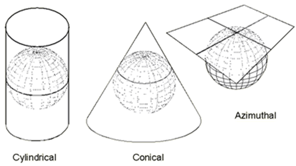
Cylindrical projections are used for areas near the equator and for the entire earth but with very large distortions. Conical projections are good for mid-latitudes while azimuthal (or planar) are good for the poles.
Projecting the entire earth to 2D is particularly challenging. A wide range of attempts have been made to provide "good" projections. Some of these include:
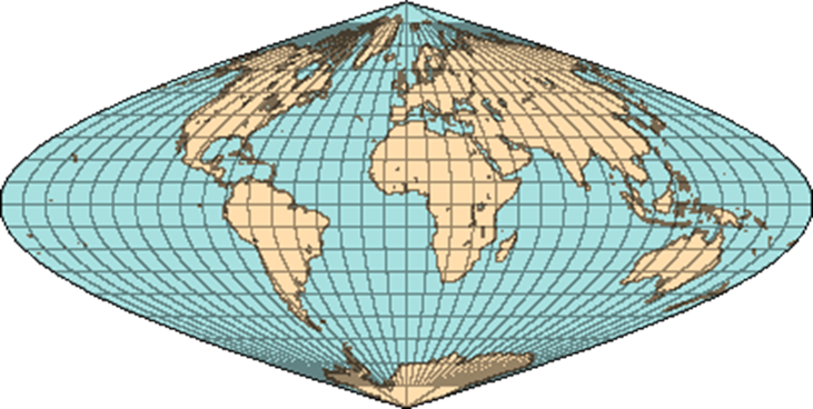
Sinusoidal
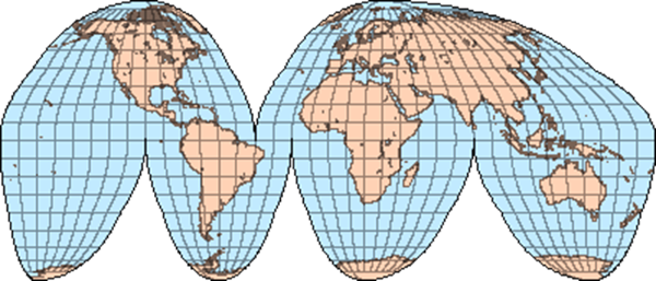
Goode Homolosine
A projection method is a mathematical formula that converts spherical data (3D) into rectangular (2D) data. This formula can then have settings that change the position of the projection on the globe.
The graphics below are taken from the USGS Projection Map (USGS Projection Map). This is an excellent resource for information on commonly used projection methods.
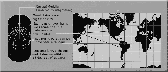
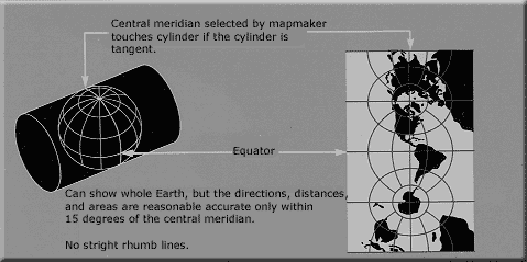
Notice in the Mercator projection method that it; is a cylindrical projection, touches at the equator and has a setting for the Central Meridian. Because it touches at the equator, the distortion near the equator is small but the distortion increases rapidly as you move away from the equator.
The "Transverse Mercator" projection method is used with the UTM projection system. It has the cylinder rotated 90 degrees so it touches the poles and along two meridians. The line of tangency is along the two lines of longitude which are specified as parameters. This is why it is used for UTM as it can represent a narrow band from pole to pole with little distortion (more on this later).
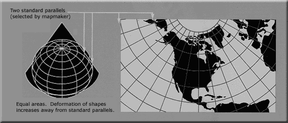
Conic projections are good for mid-latitude regions, such as North America or the continental US (CONUS).
Alber's equal area conic maintains the area with some distortion in distance and form for North America.

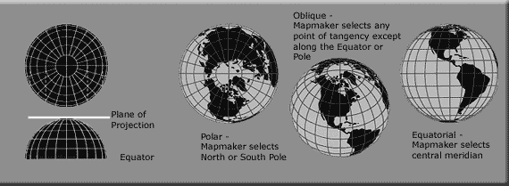
Azimuthal projection methods project geographic data onto a plane. They are typically used to represent data at the poles.
The orthographic projection is a special azimuthal projection that makes it look like we are looking at the earth in a photo graph. GoogleEarth uses this projection. Take a minute and examine the graphic and think about where the distortion is high and where it is low.
© Copyright 2018 HSU - All rights reserved.